|
Size: 1109
Comment:
|
Size: 2987
Comment:
|
| Deletions are marked like this. | Additions are marked like this. |
| Line 18: | Line 18: |
| Program mris_ca_label inputs | At first glance, mris_ca_label might appear to simply cross-reference a subject's vertex positions to atlas space and copy the labels of the nearest atlas points into an annotation file for the subject. However, the process is more sophisticated. The atlas data captures not just the most likely label for a particular atlas location. Instead, the atlas data includes the probability of a particular label given values for other measures, such as convexity and curvature of the smoothwm surface. This probability data is captured in a form refered to as "gaussian classifiers", collections of parameters at each point in a regular spherical grid. (Actually two sets of gaussian classifiers at two different grid resolutions.) Hence, in addition to the subject's ?h.sphere.reg file, mris_ca_label inputs the subject's convexity data (?h.sulc) and ?h.smoothwm surface (from which it calculates more curvature measures). This data is compared to the atlas GCs to determine the most likely label for each subject surface vertex. = Creating One's Own Atlas == To prepare to automatically label regions differently from those provided by the supplied atlases, it might be desirable to create one's own atlas. (In a few circumstances, it might also be desirable to develop a new surface registration template; see this topic: SurfaceRegAndTemplates.) To create an atlas, the labor-intensive first step is manually create labels for the regions you want, on a group of reference subjects. These can be drawn using tksurfer, resulting in your own custom annotation file for each of the reference subjects. In some cases, it may save time to start with existing annotation files and edit them, rather than starting from scratch. (For more on labels and annotation files: LabelsClutsAnnotationFiles). With custom annotation files completed, program mris_ca_train is used, as diagrammed below. attachment:gw_make_label_atlas.gif |
| Line 23: | Line 36: |
| Xxxx | |
| Line 25: | Line 37: |
| == Label file == Xxxx |
The Automatic Surface Labeling Process; GCA Atlases
Index TableOfContents
Overview
This document provides an overview of two related topics:
How the FreeSurfer pipeline automatically labels a subject's regions (producing an annotation file) by comparing the subject's curvature data to an "atlas" ("gcs") file.
The process of creating one's own atlas file, perhaps to define regions different from the ones mapped in the atlases supplied with FreeSurfer.
The Labeling Process
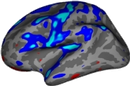
First, the labeling process depends on the subject having already been through the spherical registration process (ie: having a ?h.sphere.reg file), because the atlas data is in the same space as the registration template. This is the case for the recon-all FreeSurfer pipeline script. (The separate topic of sperical registration is described here: SurfaceRegAndTemplates.)
The labeling process itself is diagrammed below.
attachment:gw_ca_label.gif
At first glance, mris_ca_label might appear to simply cross-reference a subject's vertex positions to atlas space and copy the labels of the nearest atlas points into an annotation file for the subject. However, the process is more sophisticated.
The atlas data captures not just the most likely label for a particular atlas location. Instead, the atlas data includes the probability of a particular label given values for other measures, such as convexity and curvature of the smoothwm surface. This probability data is captured in a form refered to as "gaussian classifiers", collections of parameters at each point in a regular spherical grid. (Actually two sets of gaussian classifiers at two different grid resolutions.)
Hence, in addition to the subject's ?h.sphere.reg file, mris_ca_label inputs the subject's convexity data (?h.sulc) and ?h.smoothwm surface (from which it calculates more curvature measures). This data is compared to the atlas GCs to determine the most likely label for each subject surface vertex.
= Creating One's Own Atlas == To prepare to automatically label regions differently from those provided by the supplied atlases, it might be desirable to create one's own atlas. (In a few circumstances, it might also be desirable to develop a new surface registration template; see this topic: SurfaceRegAndTemplates.)
To create an atlas, the labor-intensive first step is manually create labels for the regions you want, on a group of reference subjects. These can be drawn using tksurfer, resulting in your own custom annotation file for each of the reference subjects. In some cases, it may save time to start with existing annotation files and edit them, rather than starting from scratch. (For more on labels and annotation files: LabelsClutsAnnotationFiles).
With custom annotation files completed, program mris_ca_train is used, as diagrammed below.
attachment:gw_make_label_atlas.gif